Outdooractive. Hike and Ride
Outdooractive AG
4.6
릴리스 세부정보
| 발행국 | KR |
| 국가 출시일 | 2018-08-16 |
| 카테고리 | Travel & Local |
| 국가 / 지역 | KR |
| 개발자 웹사이트 | Outdooractive AG |
| 지원 URL | Outdooractive AG |
| 콘텐츠 등급 | 3세 이상 |
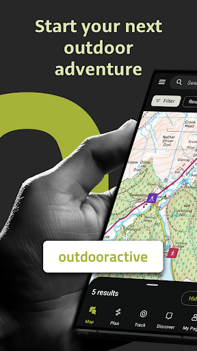
Outdooractive - Hike and Ride를 사용하여 멋진 야외 활동을 자신있게 탐색하세요. 전 세계 수천 명의 트레일 관리인, 산악 가이드 및 야외 산업 전문가가 신뢰하는 가장 신뢰할 수 있는 야외 내비게이션 앱입니다.
Outdooractive - Hike and Ride 앱은 하이킹 경로, 트레킹 코스, 산악자전거 경로, 트레일 러닝 경로, 스키 투어 경로 등을 포함한 수십 가지 스포츠에 대한 제안을 통해 여러분과 전 세계에서 공식적으로 승인된 경로를 찾는 데 도움이 됩니다. 또는 가장 심층적인 공식 지도 카탈로그를 사용하여 자신만의 경로를 계획하여 직접 모험을 떠나보세요.
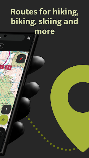
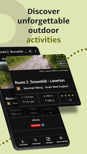
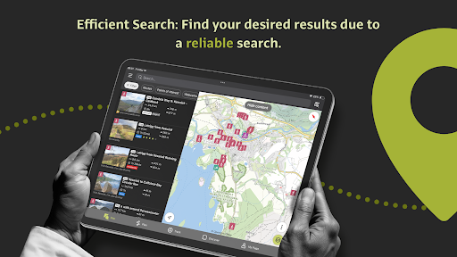
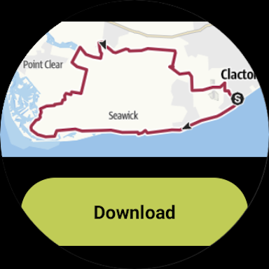
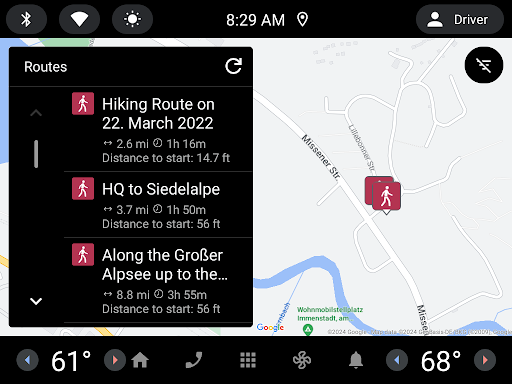
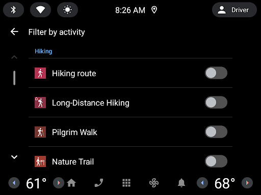
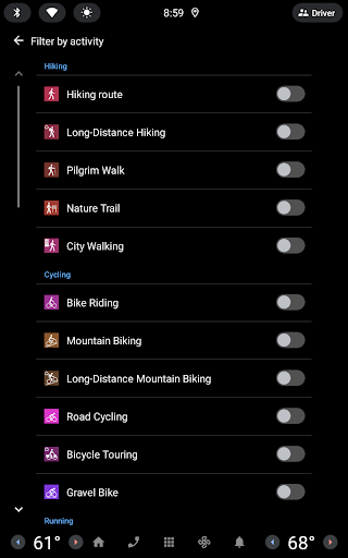
● 믿을 수 있는 경로 찾기: 하이킹, 로드 사이클링, 자전거 투어, 스키 투어, 그래블 라이딩, 트레일 러닝, 승마, 등산 등의 경로를 포함하여 가까운 곳과 전 세계에서 공식 승인된 수천 개의 경로를 찾아보세요.
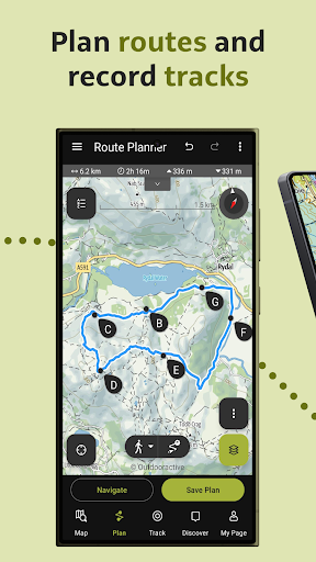
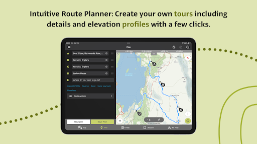
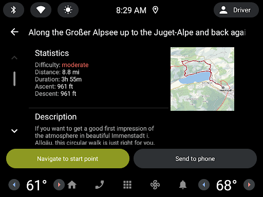
● 전문가가 신뢰하는 도구를 사용하여 자신만의 경로를 계획하세요. 몇 번의 탭만으로 경로 플래너에서 자신만의 야외 경로를 쉽게 계획하고 거리, 고도 및 지형 정보에 필요한 모든 정보를 확인할 수 있습니다.
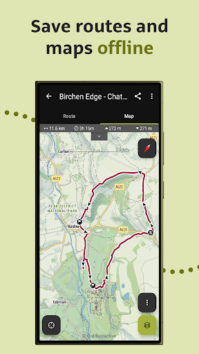
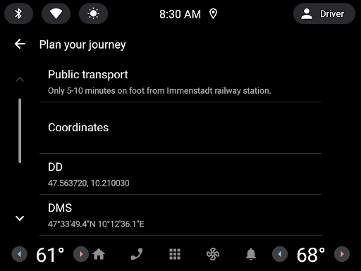
● 모든 것을 오프라인으로 저장: 전화 신호가 없을 때 안정적인 탐색을 위해 개별 계획이나 전체 영역을 오프라인으로 저장하세요.
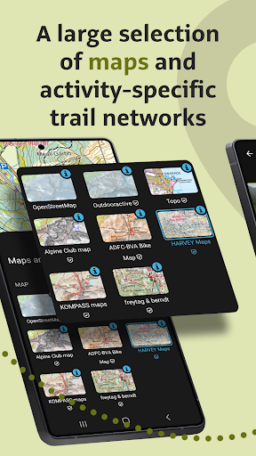
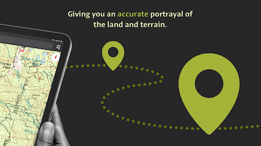
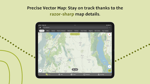
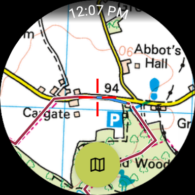
● 지구상에서 가장 신뢰할 수 있는 지도로 탐색: 다양한 지도 유형의 가장 심층적인 컬렉션을 탐색하여 자신있게 모험을 추적하거나 계획하세요. 여러 레이어 사이를 전환하기만 하면 방문하려는 지형을 더 명확하게 파악하고 지상 상태를 가장 확실하게 이해할 수 있습니다. Outdooractive의 지도 카탈로그에는 현재 다음이 포함됩니다.
- 다음을 포함한 25개국의 공식 TOPO 지도:
• 영국의 병기 조사(Landranger & Explorer)
• 뉴질랜드의 뉴질랜드 토지 정보
• 미국 USGS
• 독일 BKG
• 오스트리아의 BEV
• 스위스의 스위스토포
• 프랑스의 IGN
• 스페인의 CNIG
• 네덜란드의 PDOK
• 노르웨이의 Kartverket
• 덴마크의 Kortforsyningen
• 스웨덴의 Lantmäteriet
• 핀란드 핀란드 국토 조사
• 일본 GSI
• 영국의 가장 산악 지역에 대한 Harvey 지도
- 알프스 등반을 위한 공식 알파인 클럽 지도
- 프랑스, 독일, 오스트리아, 스위스 전역에 걸쳐 특별히 디자인된 Outdooractive 지도입니다.
● 가족 및 친구와 실시간 위치 공유: BuddyBeacon 덕분에 멋진 야외 활동을 할 때 자신과 사랑하는 사람에게 완전한 마음의 평화를 선사하세요.
● 야외 관광객 및 모험가로 구성된 글로벌 커뮤니티에 참여하세요. 커뮤니티와 활동을 공유하고, 도전에 참여하여 동기를 부여받고, 수천 개의 업계 파트너가 공식적으로 승인한 콘텐츠에서 영감을 얻으세요.
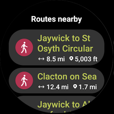
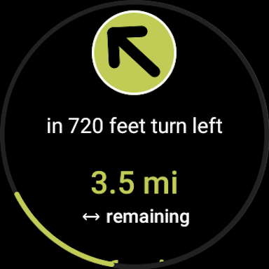
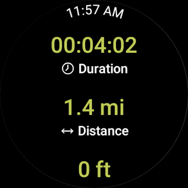
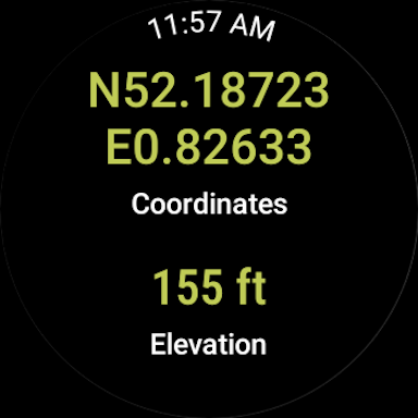
● Google의 WEAR OS가 탑재된 스마트워치: 스마트워치를 한눈에 보면 지도에서 GPS 위치에 대한 정보를 얻을 수 있습니다. 트랙을 기록하고, 추적 데이터를 얻고, 경로를 따라 탐색할 수 있습니다.
자주 묻는 질문:
Outdooractive가 내 근처 산책로를 찾을 수 있나요?
Outdooractive는 해당 지역과 전 세계에서 걷기, 하이킹, 사이클링 및 더 많은 유형의 트레일을 찾는 데 도움이 됩니다.
내 근처의 하이킹 코스를 어떻게 찾을 수 있나요?:
Outdooractive를 사용하면 앱을 열고 지도를 탐색하여 해당 지역의 하이킹 코스를 찾을 수 있습니다. 다양한 거리, 난이도, 현재 위치로부터의 거리에 따라 하이킹 코스를 볼 수 있습니다.
내 주변에서 따라가기 가장 좋은 하이킹 코스를 어떻게 알 수 있나요?:
Outdooractive의 여러 지도 레이어를 사용하면 여러 소스의 공식 정보를 보고 트레일 조건, 규칙, 제한 사항 및 하이킹에서 예상되는 사항에 대해 알 수 있습니다. 전문가들이 각 루트의 난이도, 필요한 경험치 등 정보를 공유합니다!
내 주변의 자연 산책로와 하이킹 지역을 탐색하기 위해 오프라인 지도를 다운로드할 수 있나요?:
Outdooractive를 사용하면 밖으로 나가기 전에 지도와 경로를 장치에 다운로드하여 신호가 보장되지 않는 지역을 탐색하는 데 도움을 주어 야외에서 안정적으로 탐색할 수 있습니다.
Download Outdooractive. Hike and Ride
Not Available
평균 평가
67.04K+
평가 내역
추천 리뷰
스크린샷